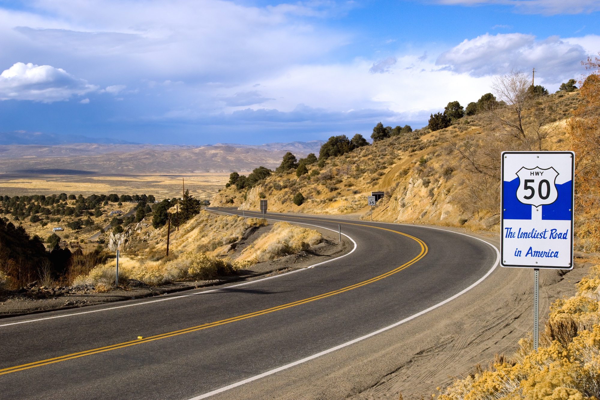
U.S. Highway 50 stretches from coast to coast, but the section that crosses the state of Nevada is considered “The Loneliest Road”. It’s a 5 ½ hour drive across Nevada, if you don’t stop. We suggest you slow down and stop often, so that you can savor the route that is also known as the California Emigrant Trail. It was part of the original Lincoln Highway, and going back way before that time; it once formed the route of the Pony Express. All this history and scenery make for a great road trip.
We suggest you begin at the western end of the Loneliest Road and make your way eastward. Start at the Harrah’s in Stateline, Nevada, and have your picture taken with the Pony Express Statue there. The Pony Express moved the mail 2,000 miles (that is half the continent) from St Joseph, Missouri, to San Francisco, in just 12 days in the summer and 14 days in the winter, from April 1860 to November 1861. It provided the Union with a link to the Western outposts, such as the Comstock silver mines and the California gold fields. The Pony Express had to overcome vast distances, racing landscapes and time itself. At the completion of the transcontinental telegraph on October 24, 1861, suddenly messages could be sent from coast to coast in minutes. The Pony Express lasted only 27 days after that; but will live in the imagination of America forever.
Head along the shore of the lake to Cave Rock Tunnel. Amazingly, there was once a one-lane hanging bridge for drivers to get around Cave Rock, the remains are there to this day, visible between the rock and the lake. The cave is sacred to the Washoe people, and in deference to them, climbing is not permitted in the area. Next you will arrive at Carson City, named for Kit Carson. The mining center near the Comstock Lode is nearby under the east side of Mt. Davidson. William Randolph Hearst’s father made his fortune there. You will want to see the sites in Carson City including the Nevada State Capitol, the original capitol which still houses the governor’s office and offers museum exhibits. The Nevada State Museum is in the former mint building, where you can see mining, rock and prehistoric exhibits, as well as a recreation of a village from the Wild West. The Nevada State Railroad Museum has the Inyo locomotive and the old Wabuska Station. The Steward Indian School, Foreman-Roberts House Museum and the Sears-Ferris House (private) are other local landmarks. Naturally, there was a Pony Express Station in Carson City.
Swing up to Virginia City (pop 880) to take in the history and the appealing old West flavor there. One of the most famous towns in the West, Virginia City was a center for the mining district, so gold-rustlers, silver-miners, outlaws and lawmen walked theses wooden boardwalks. You will have a treat exploring the old buildings and the ancient cemetery, and soaking in some of the lore and legends. As you traverse the Lahontan Valley, picture it as it was thousands of years ago—a prehistoric lake. Now, the lakebed is the landscape all around you. There were two different Pony Express stations in Dayton, but they are both gone now. One is a gravel pit and the other is now the site of the Union Hotel. Look for the free-standing rock wall that is the remount station for the Overland Stage Station and Pony Express stop. You may want to visit Dayton State Park while you are there.
By now you understand that the Loneliest Road is also the Most Peaceful Road in America. See Silver Springs and the Lahontan Reservoir and Recreation area. At Silver Springs, take a detour south on NV Alt 95 to Fort Churchill State Historic Park, to see another of the Pony Express stations; the walls of the old fort are awesome to behold. Then, retrace back to 50 and continue eastward. In Hazen, the Hazen Store is famous for its lonesome location and for its nostalgic charm. This old bungalow with a stepped false front has vintage gas pumps outside and loads of character inside. The central portion began life in 1904 as a saloon called Shorty’s Bar. Stillwater is still inhabited but it is mostly a 19th-century ghost town. See the rustic buildings in old business district, on this most serene drive.
Backtrack by way of Alt 50 to Fernley to get your passport stamped. Fernley is home to a huge Amazon.com center as well as the Reno-Fernley Raceway. Fernley claims to be in the middle of one of the fastest growing areas of the USA. The old railroad bridge over the Truckee River is quite photogenic. The town of Fallon was founded in 1908. A huge pink Victorian house, the Douglass Mansion, is a local landmark. The Fallon Movie Theatre still shows movies. See the Churchill County Museum & Archives with educational exhibits representative of the people who settled in this area. There is also a huge mineral display. The gift shop is small, but has some unique items at good prices. You will be impressed by the Native American displays. Fox Peaks Station in Fallon is run by the Paiute-Shoshone tribe and offers an adobe themed convenience station with a variety of Native American arts and crafts for sale. Also at Fallon is the Naval Air Station which has served as the home of the Topgun training program since 1996. Seven miles east of Fallon, adjacent to Highway 50, is the Grimes Point Petroglyph Trail. There are rocks with carvings eight thousand years old, created by native peoples who were drawn to the shores of ancient Lake Lahontan. The trail is a short half mile level path, and there are free brochures explaining the native art. There is also a bat cave. The Grimes Point site archaeological complex includes a variety of materials, caves, shelters, and other archaeological sites.
Continuing on this Most Open Road in America, look for the pull-off for Sand Springs Pony Express Station – there is an interpretive sign as well as many of the stone walls of the old station still standing. Tours are self guided. While you are there just stop a moment and look in all directions and imagine you have a fresh pony waiting for your next leg of the lonesome journey. Sand Springs Station was covered by drifting sand and forgotten until it was rediscovered by a team of archaeologists in 1977. If you explore Sand Mountain Recreation Area, chances are you will not be lonely. Managed by the U. S. Department of the Interior, Bureau of Land Management, the sand dunes of the 4,795 acre recreation fee area provide challenge and excitement for off-highway vehicle riders, hikers & sand boarders. As you continue this long lonely stretch of road, keep a look out for wild horses, and for more of the abandoned Pony Express stations. The Cold Springs Pony Express Station is on US 50, with an interpretive center near the highway. Read about the history of the site and take the mile-and-a-half trail to the station. The structure was built of large native rocks and mud in 1860; the stream that watered the horses still runs beside the ruins.
At Austin, see the Berlin-Ichthyosaur State Park, it is a well kept ghost town from which there are short and long hiking trails and also a weekend mining tour. The ichthyosaur fossil site is a short drive up into the hills past Berlin. The museum is built around the fossil site. Austin is famous for its stone churches. Also at Austin, see Stokes Castle, just south and west of town. It is an oddity to be sure: a three story mini-castle tower built for the wealthy Stokes Phelps family on their trek westward. It was begun in the fall of 1896, with workers hoisting the stones by hand winches, and completed in June, 1897. The family stayed there for about a month and then abandoned it. The Castle is surrounded by chain link, so not really tour-able but photographers rave about the views and sunsets here.

You are now in the vicinity of part of the Humboldt-Toiyabe National Forest Range, the largest National Forest in the lower 48. The Forest consists of 6 million acres in 23 different Wilderness Areas. The Hickison Petroglyph Recreation Area is less than a mile off the highway on a well-maintained gravel road. There are restrooms and picnic tables, but no water, so plan accordingly. Camping is also available. The trail is an easy hike of about 1/2 mile. There are a couple of scenic viewpoints along the trail. The petroglyphs are easily visible. It is the perfect place for a backward glance at ancient history. In this stretch, Summit Mountain is visible off to the south of 50. Also south of 50, if you are in an all terrain vehicle, follow the signs to abandoned and picturesque Belmont Mill and from there you can hike to the top of Mt Hamilton.
By the time you get to Ely, this Most Spacious Road in America will have captured your soul. Ely began as a stagecoach station along the Pony Express and Central Overland Route; and then it was a copper boomtown. Today, Ely is home to the Nevada Northern Railway Museum. Rock hounds can search for gems at Garnet Hill. See an amazing collection of beehive shaped charcoal ovens at the Ward Charcoal Ovens State Historic Park; it is down a gravel road but quite accessible by passenger car.
Looking for more of the Quietest Road in America? White Pine County has some notable and photogenic Nevada ghost towns: Hamilton was once the county seat, but after a fire in 1873, the town never fully recovered and the county seat was moved to Ely. Osceola is famous as the place where the largest gold nugget in Nevada was found. This mining boom town grew to a population of 1,000 in the 1870’s, but when the mine gave out, it became the ghost it is today. One old miner lives in there now, beside the old Assayer’s office, the last remaining structure in town. The Pony Express riders traveled thru the Cherry Creek area in 1860-1861. In the 1870s and 80s, gold and silver were mined there. It is now mostly empty except for the ruins of the old mining operations.
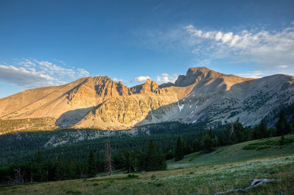
As Route 50 nears the state line with Utah, you come to Great Basin National Park, which is best to see in the spring, summer or fall time of year. Begin at the visitor center near the friendly town of Baker, Nevada. Then explore the park. For many the highlight is the Lehman Cave tour; advance reservations are advised. The road to the Wheeler Peak viewpoints, the views of Lake Teresa, and the Bristlecone Trail are all rewarding. All of the water in this region evaporates, sinks underground, or flows into lakes. None of it reaches the ocean. Great Basin National Park is also home to Lexington Arch, one of the largest limestone arches in the western United States. This six-story high arch was formed by the weather over many centuries. Access to the arch was closed after the 2013 fires, so check before you go to find out if the hike there is still closed. The 1.7 mile hike to Lexington Arch originates in the Humboldt-Taiyabe National Forest.
If you stop at any of the Chambers of Commerce along the way, you can get an “I Survived the Loneliest Highway in America” Kit. Then you can have the map from the kit validated at the stops along the way. If you mail the completed map as instructed, you will get a certificate and pin in return. Remember that the Loneliest Road has 17 mountain passes, amazing long empty stretches of straight flat road, more sagebrush than you can imagine, and very few services, so plan accordingly.
Just for fun, watch this video of a 1947 Ford driving the Loneliest Road:

